google.com, pub-2829829264763437, DIRECT, f08c47fec0942fa0
Showing posts with label Landscapes. Show all posts

Tuesday, October 9, 2018

Montreal's Old Port

Montreal's Old Port


The Old Port of Montreal is the historic port of this city. This site was used as early as 1611, when French fur traders used it as a trading post.

The historical Old Port was redeveloped in the early 1990s, under the direction of architects Aurèle Cardinal and Peter Rose.Today the Old Port offers Montrealers and visitors alike access to a wide variety of activities, including the Montréal Science Centre, with an IMAX Theatre, and the Montreal Clock Tower.

It offers riverfront access for walking, cycling, roller-blading, quadricycle, pedalo and Segway rentals. The area  as a popular destination for cycling, roller-blading and pleasure boating.

In June 2012, an urban beach, called the Plage de l'Horloge (Clock Beach), opened adjacent to the Clock Tower.

The historical Old Port was redeveloped in the early 1990s, under the direction of architects Aurèle Cardinal and Peter Rose. It is today a recreational and historical area. The Old Port offers Montrealers and visitors alike access to a wide variety of activities, including the Montréal Science Centre, with an IMAX Theatre, and the Montreal Clock Tower. It offers riverfront access for walking, cycling, roller-blading, quadricycle, pedalo and Segway rentals. The area as a popular destination for cycling, roller-blading and pleasure boating. In June 2012, an urban beach, called the Plage de l'Horloge (Clock Beach), opened adjacent to the Clock Tower. Every 2 years the Cirque du Soleil launches a new show from the Jacques Cartier Quay.

The Old Port is managed by the Old Port of Montreal Corporation, a subsidiary of Canada Lands Company, but it reports directly to the government.

In the 19th century, transporting goods along the St. Lawrence River was no simple task. Downstream near the Jacques Cartier Bridge, the Sainte-Marie current was so powerful that some boats had to be hauled through. Upstream in the western part of the river, the Lachine Rapids – the result of a 14-metre drop between Lake Saint-Louis and Laprairie Basin – thwarted the expansion of the port.

Until the turn of the 20th century, the sudden mid-winter thaws and inevitable spring ice jams considerably hindered the development of the port of Montreal. Masses of ice measuring up to 15 metres high caused devastating floods, including the most memorable flood of 1886. The repeated flooding prevented the construction of permanent infrastructures.

MacKay Pier (now known as Cité-du-Havre Point) was built between 1891 and 1898 to keep the ice flow in the St. Mary`s current and away from the shore. A cut stone firewall was built along de la Commune Sttreet in 1899. Finally protected, the port of Montreal could expand. Year-round navigation only became possible in 1964, when icebreakers started breaking the ice in order to open the St. Lawrence navigation canal.

De la Commune Street. This street separates Old Montreal from the Old Port. It stretches for over two kilometres along the St. Lawrence River in Old Montreal. 
The Souvenir Tower, also known as the Clock Tower (Tour de l'Horloge.
Old Port rapids.In the old times, the repeated flooding prevented the construction of permanent infrastructures.

Bonsecours bassin of the Old Port of Montreal.

Tour of  the Horloge (The Clock Tower).

Until the turn of the 20th century, the sudden mid-winter thaws and inevitable spring ice jams considerably hindered the development of the port of Montreal.

Old port of Montreal, general view.

Bonsecours Church as seen from the Old Port.

Bonsecours Bassin.
Upstream in the western part of the river, the Lachine Rapids – the result of a 14-metre drop between Lake Saint-Louis and Laprairie Basin – thwarted the expansion of the port.

Every 2 years the Cirque du Soleil launches a new show from the Jacques Cartier Quay.In the 19th century, transporting goods along the St. Lawrence River was no simple task.

Centre of Science in Old Port of Montreal.
A blue installation.
MacKay Pier (now known as Cité-du-Havre Point) was built between 1891 and 1898 to keep the ice flow in the St. Mary`s current and away from the shore.
A cut stone firewall was built along de la Commune Street in 1899.
Locks of love in the Old Port of Montreal.
Trails of  the Old Port.
Cartier Bridge as seen from the Old Port.

Monday, October 8, 2018

Newest National Parks

America's Newest National Parks

These desert lands are an oasis for those thirsting after beauty


Two new national parks and a new national preserve belie popular myths about American desert lands. Created by the 1994 California Desert Protection Act, Death Valley National Park, Joshua Tree National Park, and Mojave National Preserve, all in California's Mojave Desert, are not simply cactus-strewn sandboxes. In fact, they are practically teeming with some 700 species of plants and 760 species of wildlife, some of which are extremely rare.

And cultural artifacts also appear on the arid landscape, from mysterious ancient pictographs to the Boeing  burial ground, where the aircraft manufacturer has laid several 748s to rest.

Gas, water, food are few and far between, though, and summer daytime temperatures average more than 100 degrees. Make sure you consult a map carefully before you travel. The best months for visiting are October through May.

Death Valley National Park


At 5,000 square miles, it is now the largest national park in the lower 48 states. Badwater, the lowest and hottest place in the United States, is located here, but many of the mountains in the park can be chilly, even in the summer. Notable sites include Eureka Valley's 700-foot sand dunes and Scotty's Castle, the opulent home of an early prospector. Death Valley is probably the most visitor-friendly of the new national parks, with hotels, campgrounds, and even a golf course within its boundaries.

Joshua Tree National Park


National Monument Dr. Twentynine Palms, Ca.

Ansel Adams shot some of his most famous landscape photographs here. Home of the gnarly, 20- to 40-foot Joshua tree it is also a world-famous spot for rock climbing. Although there are adequate camping facilities in the park, one might want to stay instead in Tewntynine Palms or Palm Springs for the comforts of cilvilization.

Mojave National Preserve


Lake Mead National Recreation Are, 601 Nevada Highway, Boulder City, NV.

Initially proposed as a national park, but downgraded to a national preserve to allow hunting. With 19 mountain ranges, groves of white fir and Joshua trees, limestone caves, and extensive, ancient petroglyphs, there is plenty to keep one occupied. Of the new parks, however, the Mojave is probably the least equipped for visitors, with a few campgrounds and no towns nearby.

And cultural artifacts also appear on the arid landscape. Photo by Elena.

Sunday, October 7, 2018

All Aboard the Orient Express

All Aboard the Orient Express

Eight incredible rail journeys that take you to Hell and the Outback


For years I have been traveling the great rail lines as a life-long lover of a rapidly disappearing way of looking at the world. Here is a highly subjective listing of some of my favorites, based on the scenery outside, the service inside, and the ever-intangible “romance factor.”

The California Zephyr – Chicago to Oakland


The original California Zephyr of 1949 was conceived as a cruise train – the journey was just as important as the destination and took 8 to 10 hours longer than the competition. Its successor continues that tradition by scheduling the three-day trip to time the best scenery with daylight hours, leaving Chicago in the afternoon and arriving in Denver the following morning so you wake up to see the breathtaking beauty of the Rockies. Along the way in the passage through the Sierra Nevada and a fine view of San Francisco Bay. It offers Amtrak's largest helping of scenery.

The Cariboo Dayliner – British Columbia, Canada


The fourteen-hour trip from North Vancouver to Prince George includes some spectacular and seldom-seen scenery through the Coast Mountains and up the Fraser River Valley. For a day trip, travelers can get off in Lillooet to return to North Vancouver by sunset. BC Rail runs the trains daily in the summer and three times a week in the winter. The cars are not particularly luxurious, but their enormous windows allow the scenery to work its magic. Reserved seats include a meal.

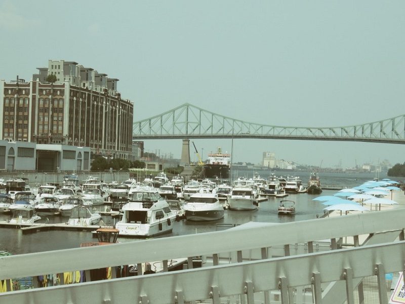
A train! Photo by Elena.

Copper Canyon – Mexico


This line along the edge of Mexico's spectacular Copper Canyon (for times the size of the Grand Canyon) and through the Sierra Madre was proposed at the turn of the XXth century as a short route from Kansas City to the Pacific and completed 60 years and one revolution later. The 14-hour trip includes a 15-minute stop to view the rugged canyon bottom. Stay overnight in Los Mochis for the return trip, or – if you are ambitious – make the somewhat unpredictable trip overland and by ferry to Baja California.

Indian Pacific – Sydney to Perth, Australia


This three-days trip covers 2,720 miles, from the Pacific through the Blue Mountains west of Sidney and across the outback to Perth and the Indian Ocean. Most of the journey is spent in the austere beauty of the Nullarbor Plains, where one stretch of track goes 297 miles without a curve. Passengers can kivk back in luxuriosly refurbished lounge cars as they watch wild kangaroos leap across the outback. One of the attractions is going completely across something.

The Oslo-Trondheim-Bodo-Narvik – Norway


Surprisingle enough, Hell is located near the Arctic Circle. It is a small town nestle in the Dover Mountains of Norway, just a few miles from Trondheim and not nearly as unpleasant as its namesake. Norwegian State Railways operates several day trains and a night train through the mountains. The scenery is austere, but the trains are comfortable and well-equipped. Sharp-eyed travelers may sight the occasional musk ox.

Rhaetian Railway Benina Line – The Swiss Alpa


This train descends some 4,000 feet as it makes its way from Chur, Switzerland, across the Benrina Pass and into Tirano, Italy – all without the reassuring traction that cog railways offer. It is the highest crossing of the Alps by any rail line. The train itself is not particularly exciting, but the scenery is unsurpassed. There is no dining car, but travelers have about an hour in Italy to buy ice cream before the return trip. Eurail passes are valid, or travelers can make reservations at any Swiss train station. The express line travels each way once a day. Book through a travel agent or call the rail line in Switzerland for details.

The Trans-Siberian Railway – Moscow to Vladivostok


A seven-day journey into the Far East on the world's longest continuous rail line. Of the regular trains on this route, the Rossiya is the best. It's not luxurious, but it does offer sleeping berths and a dining car. The entire trip can exhausting, so you may want to take it in bits and pieces. A consortium of Eastern and Western businessmen have put together a charter train, called the Rhythm, that runs the same route on occasion and offers world-class dinging and the height of luxury. The best part of the trip is finding out that a country that was once absolutely forbidden is absolutely beautiful.

Venice Simplon-Orient-Express – Paris to Budapest or Venice


Perhaps the ultimate experience in pampered land travel, on of the most famous of train lines. Murder is rare, but fine dining and classic details like posh, overstuffed upholstery are not. The cars have been restored so authentically that most of them do not have air conditioning, so you may want to avoid travel during the hottest months. The dining car service is that of a four-star restaurant. Uniformed gold-braided stewards will go out of their way to make your trip a comfortable one. We recommend the southbound line for scenery, but you should take the trip for what's inside the windows.

Rocky Mountain National Park

Rocky Mountain National Park


3 million visitors per year – 414 square miles – One of the highest regions in the country – 114 mountains above 10,000 feet – Superintendent, Estes Park.

On both sides of Rocky Mountain National Park's 44-mile Trail Ridge Road, the highest paved road in America, are craggy snow-capped mountain peaks shrouded in clouds, alpine fields ablaze with wildflowers, and crystal-clear mountain lakes. Elk, deer, mouse, coyotes, marmots, ptarmigan and the bighorn sheep – the symbol of the park – can often be seen.

Peak season tips: The road to Bear Lake is one long traffic jam in the summer. Consider spending most of your time on the west side of the park; it's less spectacular, but also less crowded, and there are better opportunities to see wildlife.

Camping: There are five campgrounds in the park, each with a seven-day camping limit. For reservations to Moraine Park and Glacier Basin campgrounds, call Mistix. The other three are available on a first-come, first-served basis. In the summer, Timber Creek, on the west side of the park, is recommended – it doesn't fill up until about 2 p.m. Aspenglen and Longs Peak, where one begins the ascent to the summit, are often full by 8 a.m. Privately owned campgrounds also are available.

Best one-day trip: For a sampling of the varied topography, take Fell River Road to the Alpine Visitors Center at Fall River pass, 11,796 feet above sea level. Drive back along Trail Ridge Road. If time permits, turn off Trail Ridge road onto Bear Lake Road, which winds past lakes and streams to Bear Lake, where there is an easy a 1.1-mile hike to Dream Lake. A less-crowded trail nearby is the Glacier Gorge Junction Trail to Alberta Falls. Those who are in peak physical condition may want to attempt Long's Peak Trail, a strenuous 8-mile hike. A third of the 15,000 people who attempt it every year don't make it – at 14,000 feet, there is 40 percent less oxygen in the air.

Best experience: Eighty percent of the park's trails can be ridden on horseback, and there are two historic ranches at the center of the park. Horses can be rented from livery concessions in Glacier Basin and Moraine Park. For a list of nearby ranches, many of which of offer accommodations, contact the park administration. 

Flowers blossom. Photo by Elena.

Manhattan - Part I

New York, Manhattan, Part I


Manhattan is coextensive with New York County, one of the original counties of the U.S. state of New York. The borough consists mostly of Manhattan Island, bounded by the Hudson, East, and Harlem rivers; several small adjacent islands; and Marble Hill, a small neighborhood now on the U.S. mainland, physically connected to the Bronx and separated from the rest of Manhattan by the Harlem River. Manhattan Island is divided into three informally bounded components, each aligned with its long axis: Lower, Midtown, and Upper Manhattan.

Manhattan is the cultural, financial, media, and entertainment capital of the world, and the borough hosts the United Nations Headquarters. Anchored by Wall Street in the Financial District of Lower Manhattan, New York City has been called both the most economically powerful city and the leading financial center of the world. Manhattan is home to the world's two largest stock exchanges by total market capitalization: the New York Stock Exchange and NASDAQ. 

Many multinational media conglomerates are based in Manhattan, and the borough has been the setting for numerous books, films, and television shows. Manhattan is historically documented to have been purchased by Dutch colonists from Native Americans in 1626 for 60 guilders. Manhattan real estate has since become among the most expensive in the world, with the value of Manhattan Island, including real estate, estimated to exceed US$3 trillion in 2013; median residential property sale prices in Manhattan approximated US$1,600 per square foot ($17,000/m2) as of 2018, with Fifth Avenue in Midtown Manhattan commanding the highest retail rents in the world, at US$3,000 per square foot ($32,000/m2) in 2017.
Broadway and Union Square.
Union Square from Another Angle.
Lyceum.
Liberty street.
Liberty street and Massau corner.
Canal street and Laight street.
Manhattan unknown.
Downtown.
Manhattan's Skycrapers.
View on the river and the pier of the FDR drive.
An artwork in the heart of Manhattan.
A church.
Lower Manhattan.
Spike of a tower.
An artistic installation.

Saturday, October 6, 2018

Yosemite National Park

Yosemite National Park


4 million visitors per year – 1,170 square miles – Home of the giant sequoia. Yosemite National Park, CA.


Yosemite's majestic granite peaks, groves of ancient giant sequoia trees, and waterfalls, including Yosemite Falls,which at a height of 2,425 feet is the nation's highest inspired some of the earliest attempts at conservation in the United States. In 1864, Congress enacted laws protecting the valley. Journalist Horace Greeley, who once visited this park, noted that he knew of “no single wonder of Nature on earth which can claim a superiority over the Yosemite.” And naturalist John Muir, whose efforts led to the park's formation, said of the valley. “Not temple made with hands can compare with Yosemite.”

The enormous park occupies an area comparable to Rhode Island, with elevations of up to 13,114 feet.

Peak season tips: During the busy summer months, forgo the sights and splendors of the seven-mile Yosemite Valley, which attracts the hordes.

Camping: Of the 18 campgrounds in Yosemite, the 5 main ones in the valley offer “refugee-style camping” - over campsites crammed into a singularly unspectacular half-mile. For more space and better views, head for the hills and try one of the eight Tioga Road campgrounds. There also are five tent camps about a day's hike from one another on the High Sierra Loop Trail. Campers can obtain meals, showers, and cots there. Reservations via Yosemite Reservations are advised.

Reservations also are required year-round in Yosemite Valley's auto campground and for Hodgdon Meadow, Crane Flat, and Tuolumne,  Meadows campgrounds. All other campgrounds are operated on a first-come, first-served basis. Camping reservations may be made up to, but no earlier than, eight weeks in advance through Mistix. Reservable campsites fill up quickly from mid-May to mid-September. Your best bet for snagging a spot is to start calling the Mistix reservation number at 7 a.m. Pacific Standard Time eight weeks in advance of the date you want to camp. 

Best one-day trip: Avoid the congested route to Yosemite Valley. Instead, grab a tour bus and get off either at shuttle stop 7, for an easy half-mile, 20-minute hike to Lower Yosemite Falls, or shuttle bus stop 8, for a strenuous one- to three-hour round-trip hike to Upper Yosemite Falls. Other sites include the Native American Yosemite Village and El Capitan, a 2,000-foot face crawling with little black specks which, on closer inspection, turn out to be rock climbers.

In fact, the dramatic domes and soaring pinnacles in Yosemite make it one of the best places in the world for rock climbing. The Yosemite Mountaineering School and Guide Service offers beginning through advanced classes in the summer.

Nice park... Photo by Elena.

Friday, October 5, 2018

Grand Canyon National Park

Grand Canyon National Park


5 million visitors per year – 1,904 square miles – the 277-mile canyon is nearly a mile deep in places. Grand Canyon, aZ 86023.

A Grand Canyon sunset is glorious, but even during the day, the canyon walls' many layers of stone refract hues of red, yellow, and green light. On a good day, you can see 200 miles across vast mesas, forests, and the Colorado River.

The park consists of three different areas: the North Rim, the South Rim, and the Inner Canyon, which is accessible only by foot, boat, or mule. The North Rim and the South Rim are only 9 miles apart as the eagle files, but 214 miles by road.

The different rims are located in entirely different temperate climate zones. The North Rim on average is 1,000 feet higher and is heavily forested with blue spruce and alpine vegetation. It is open only from May to late October. The more popular South Rim is closer to population centers and has the juniper bushes and Gambel oak typical of the arid Southwest. The Inner Canyon is desertlike; temperatures there often exceed 110 degrees in the summer.

Follow the trails! One-and two-day mule rides are a somewhat bumpy alternative to hiking the Grand Canyon. Avoid rides in the summer, when temperatures can reach 118 degrees. Two-days trips start at the South Rim. Photo by Elena.

Peak season tips: The South Rim is crowded all year. To escape the masses, take one of the many trails off East Rim Drive to a private spot overlooking the canyon, or try the North Rim. Which receives only ten percent of the park's visitors.

Camping: Lodging reservations South Rim, including Phantom Ranch, North Rim Lodging reservations. Recorded general park info is available.

Best one-day trip: The West Rim Drive offers wonderful views of the main canyon. In the summer, it is open only to buses, which can be taken from the visitor center. A paved trail runs along the South Rim offering an easy bike. All hikes into the canyon are strenuous. Of them, only the Bright Angel and the South Kaibab trails are regularly maintained.

Best experience: A raft ride down the Colorado River is a great way to enjoy the splendor of the canyon. Motorboat trips take 7 to 10 days, raft trips take 10 to 12 days, and trips on wooden dories usually last 18 days, though 3- to 8-days partial trips can be arranged. Write the park superintendent for a complete list of outfitters licensed by the National Park Service.

Great Smoky Montains National Park

Great Smoky Mountains National Park


10 million visitors per year – 800 square miles – Largest national park east of the Rockies – 107 Park Headquarters Rd, Gatlinburg, TN.

A world unto itself, Great Smoky Mountains National Park has over 1,500 species of flowering plants, 10 percent of which are considered rare, and over 125 species of trees – more than in all of Europe. In addition, there are 200 species of birds, about 50 species of fish, and 60 species of mammals, including wild hogs and black bears.A hike or divre from mountain base to peak is equivalent to the entire length of the Appalachian Trail from Georgia to Maine in terms of the number of species of trees and plants – every 250 feet of elevation is roughly equivalent to 1,000 miles of distance on the trail. A quarter of the park is virgin forest, the largest concentration east of the Mississippi. Some of the trees are up to 8 feet in diameter.

In addition to its natural attributes, Great Smoky Mountains is one of the most interesting national parks in the United States historically, with farms, churches, cabins, and working grist mills left by the mountain people who moved away when the park was established in 1934. The park has been designated a United Nations International Biosphere Reserve as well as a World Historical Site.

Peak season tips


 During the summer, in the lower elevations, expect haze, humidity, and afternoon temperatures in the 90s – and terrible traffic jams. Cades Cove, the less spectacular but more historically interesting section of the park, is generally less crowded in the summer.

Old and abandoned farms abound here. Photo by Elena.

Camping


Reservations are required May 15 through October 31 for Elkmont, Smokemont, and Cades Cove campgrounds. Contact Mistix Sites at other campgrounds are on a first-come, first-served basis. Stay of up to 7 days are allowed from mid-May through October, and up to 14 days the rest of year. Rarely filled are the Look Rock and Cosby campgrounds, which are in more remote parts of the park. Also of note is the LeConte Lodge, located on the park's third-highest peak (elevation, 6,593 feet), a six-hour hike from the main road. Accommodations are sometimes in cabins with no electricity or running water, but no include beds and hot meals. The lodge is open from late March through mid-November.

Best one-day trip


Entering the park from Gatlinburg, continue on US 441, and stop at the Newfoundland Gap, where there are spectacular views of the mountains. From there, turn onto Clingmans Dome Road (closed in the winter), which ends at a parking lot where there is a strenuous half-mile hike to a lookout tower atop 6,643-foot Clingmans Dome – the highest peak in the park. Back on US 441, continue to the Smokemont Campground where the easy, two-mile Chasten Creek Falls Trail meanders along a stream through a hardwood forest ending at one of the park's many waterfalls.


Best experience


The Great Smokies is one of the premier places in the East to enjoy magnificent fall foliage. The season lasts from September through October. Peak time: October 15 to October 31.

Rosedale - Part III

Rosedale - Part III


South Rosedale was first settled by Sheriff William Jarvis and his wife, Mary, in 1826 after Jarvis inherited his father's home there two years earlier. Mary Jarvis, the granddaughter of chief justice and loyalist William Drummer Powell frequently walked and rode on horseback around the trails for that formed Rosedale's meandering streets (which are one of the area's trademarks). She named the estate "Rosedale" as a tribute to the abundance of wild roses that graced the hillsides of their estate. The Jarvis estate was subdivided in 1854 and became Toronto's first "garden suburb". The Jarvis Family sold the Rosedale homestead in 1864, which led to the residential development of the area soon after, including the extension of Cluny Drive.

A noteworthy piece of Rosedale's History, is that it was home to Ontario's fourth Government House. The house was called Chorley Park, and it was built for the Lieutenant Governor in 1915.It was demolished in 1960 by the city of Toronto to save money. It is now a public park of the same name.

Park in Rosedale. White, yellow flowers in Rosedale Hot pink flower with yellow middle. White petals, yellow middle flower in background.

Chorley Park Tulips.

Rosedale rues.

Morley Callaghan (22 February 1903 - 25 August 1990). Morley Callaghan wrote 18 novels and over 100 short stories, all about Canadians. Critically acclaimed around the World, he has been compared with Chekhov and Turgenev. He sold his first story while attending Riverdale Collegiate and worked as a reporter for the Toronto Star during his student years at the University of Toronto. In 1928 he published his first novel, Strange Fugitive and in 1929 he married Loretto Dee. They lived in Paris - where they were befriended by Hemingway, Fizgerald and Joyce - then in New York and Pennsylvania until the early thirties, when they returned to Toronto. Callagahan moved to Dale Avenue in 1951. Neighours often saw and talked to him as he crossed this bridge with his wife and dog, Nikki, then with his dog, then alone until he died in 1990.
Rosedale Crescent Road park.
House on Roxborough street in Rosedale.
A big house in red bricks.
A family house in Rosedale.
Light blue flower bush, with other plants. Close ups.
A Green house.
A residential building in Rosedale.
Under the bridge of the Mount Pleasant Highway.
Cat on a Thornwood Road.
House on a Mont Pleasant Road.